Wednesday, 14 August 2024

Sarreguemines - Saargemünd


Sarreguemines
Pavillon à la française érigé à la demande de Paul de Geiger en 1880; Château de Utzschneider aujourd'hui Hôtel de la Communauté d'Agglomération; Casino des Faїenceries (construction 1878) fût le lieu de recontre et de distraction des employés et ouvriers de la faїencerie (aujourd'hui salle de spectacle et restaurant); Passerelle fleurie René Ludwig, Maire de la ville de 1995 à 2001; Église Sainte-Nicolas;  Paroisse protestante de Sarreguemines; Église Saint-Denis de Neunkirch; La gare


Saargemünd
Französischer Pavillon, der auf Wunsch von Paul de Geiger 1880 errichtet wurde; Schloss Utzschneider, heute Hotel der Communauté d'Agglomération; Casino des Faїenceries (Baujahr 1878) war der Treffpunkt und Vergnügungsort der Angestellten und Arbeiter der Faїencerie (heute Veranstaltungssaal und Restaurant); Blumensteg René Ludwig, Bürgermeister der Stadt von 1995 bis 2001; Kirche Sainte-Nicolas; Protestantische Gemeinde von Sarreguemines; Kirche Saint-Denis de Neunkirch; Der Bahnhof


Sarreguemines
French-style pavilion built at the request of Paul de Geiger in 1880; Château de Utzschneider, now the town hall of the Communauté d'Agglomération; Casino des Faïenceries (built in 1878), once a meeting place and entertainment venue for employees and workers of the earthenware factory (now an auditorium and restaurant); Passerelle fleurie René Ludwig, Mayor of the town from 1995 to 2001; Church of Sainte-Nicolas; Protestant parish of Sarreguemines; Church of Saint-Denis de Neunkirch; Railway station.

Stamps:
Playing cards

MDa 3034


A MÁV MDa 3034 pályaszámú dízel-hidraulikus mozdonya Szentes Vontatási Főnökségen, 
1977. július 5-én

Diesel-hydraulic locomotive MDa 3034 of MÁV in Szentes, 5th July 1977

Dieselhydraulische Lokomotive MDa 3034 der MÁV in Szentes am 5. Juli 1977

Stamps:
Transilvanian hunting dog
Year of the Rabbit 2023
Town's gym in Nagyatád
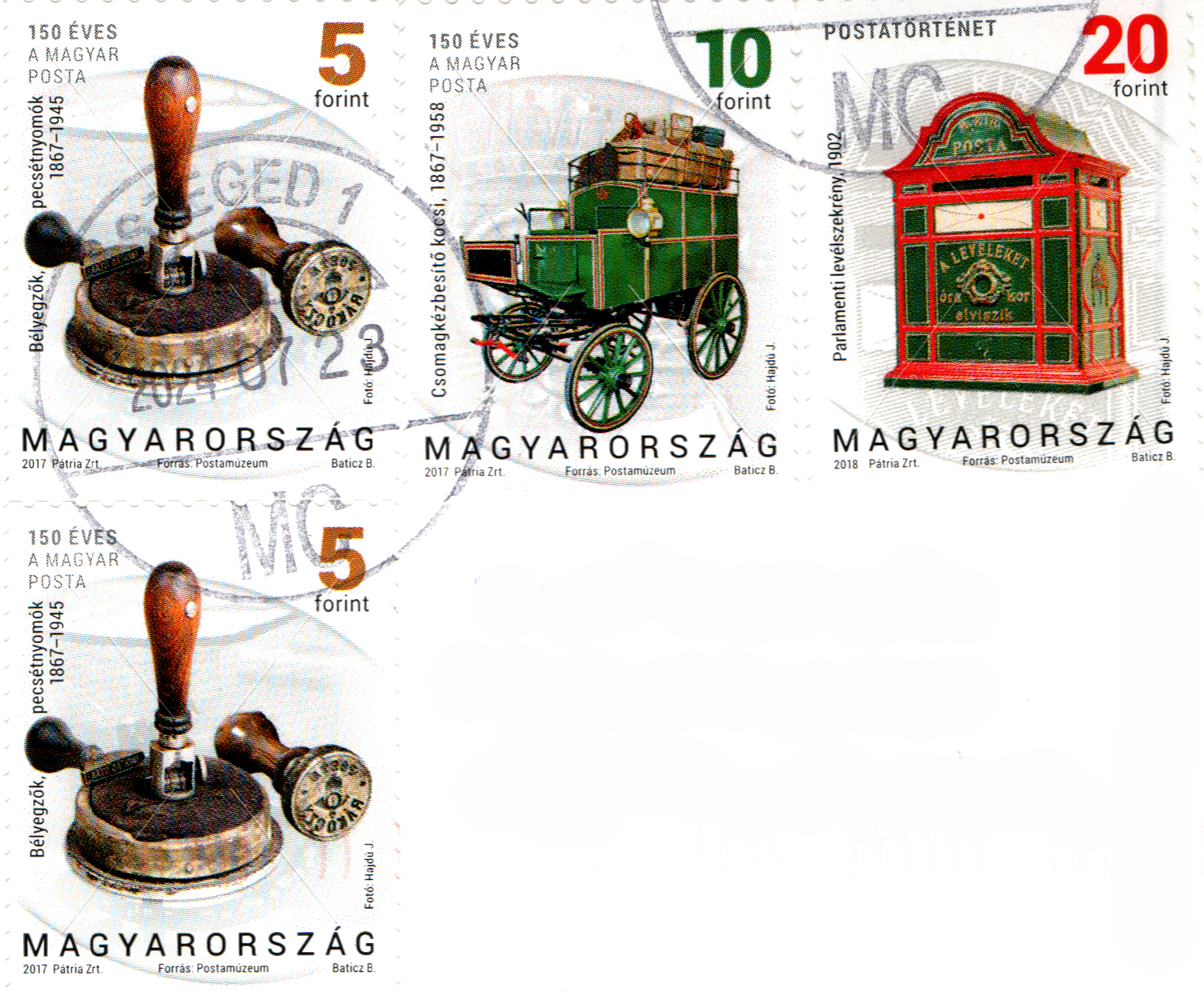
Postmark stamper

Saturday, 10 August 2024

Kiskunfélegyháza


Városháza
A Kiskunfélegyháza városháza építését 1891-ben kezdték el, és az épület 1893-ban készült el. Az építkezés során a neogótikus és eklektikus stílusjegyeket ötvözték, ami akkoriban népszerű volt a középület-építészetben Magyarországon. Az épület azóta is fontos szerepet játszik a város életében, mint a helyi közigazgatás központja.


Town Hall
The construction of the Kiskunfélegyháza Town Hall began in 1891 and the building was completed in 1893. It was built in 1893, combining neo-Gothic and eclectic styles, which were popular in public architecture in Hungary at the time. The building has since played an important role in the life of the town as the centre of local administration.


Rathaus
Mit dem Bau des Rathauses von Kiskunfélegyháza wurde 1891 begonnen, und das Gebäude wurde 1893 fertiggestellt. Es wurde 1893 in einer Kombination aus neugotischem und eklektischem Stil erbaut, die damals in Ungarn in der öffentlichen Architektur beliebt waren. Das Gebäude spielt seither eine wichtige Rolle im Leben der Stadt und ist das Zentrum der lokalen Verwaltung.

Stamps:
GAZ-12 ZIM
English garden in Tata
Kinizsi castle in Nagyvazsony
100th Anniversary of the steam locomotive 424
Water tower in Siofok

Michel - Emil


Michel aus Lönneberga
Michel aus Lönneberga ist die Hauptfigur einer beliebten schwedischen Kinderbuchreihe und TV-Serie, geschrieben von Astrid Lindgren. Ursprünglich hieß die Figur Emil, doch in der deutschen Übersetzung wurde der Name in Michel geändert.

Michel ist ein fröhlicher und abenteuerlustiger kleiner Junge, der in dem Dorf Lönneberga in der schwedischen Provinz Småland lebt. Er ist sehr neugierig und ständig auf der Suche nach neuen Streichen. Nach jedem Streich sperrt sein Vater, Anton, Michel in den Holzschuppen, um ihn zu bestrafen. Dort vertreibt sich Michel die Zeit mit dem Schnitzen von Holzfiguren, während seine Familie allmählich erkennt, dass er in Wirklichkeit gar nicht böse ist, sondern einfach eine lebhafte Fantasie hat.
 

Emil i Lönneberga
Emil i Lönneberga (på tyska känd som Michel aus Lönneberga) är huvudpersonen i en populär svensk barnbokserie och TV-serie, skriven av Astrid Lindgren.
 
Emil är en glad och äventyrslysten liten pojke som bor i byn Lönneberga i Småland, Sverige. Han är mycket nyfiken och ständigt på jakt efter nya bus. Efter varje bus låser hans pappa, Anton, in Emil i snickarboden för att straffa honom. Där fördriver Emil tiden med att tälja trägubbar, medan familjen så småningom inser att han egentligen inte är elak, utan bara har en livlig fantasi.

 
Emil from Lönneberga
Emil i Lönneberga is the main character in a popular Swedish children's book series and TV show written by Astrid Lindgren. 
 
Emil is a cheerful and adventurous young boy living in the village of Lönneberga in Småland, Sweden. He is very curious and always looking for new pranks to pull. After each prank, his father, Anton, locks Emil in the wood shed as a form of punishment. While in the shed, Emil spends his time carving wooden figures, and his family gradually realizes that he is not actually bad but simply has a lively imagination.
 
Stamp:
Emil

Cancellation:
First Day of issue

Danke, Sybille

Kádár címer - Coat of Arms of the P.R. of Hungary


A Magyar Népköztársaság címere

Az úgynevezett Kádár-címer az 1956-os forradalom vérbe fojtása után, 1957-ben lett a Magyar Népköztársaság hivatalos állami jelképe. A nemzeti identitás és a szocialista ideológia közötti kompromisszumként megalkotott embléma tudatosan mellőzte a tradicionális szimbólumokat, mint például a Szent Koronát. A címer közepén a piros, fehér és zöld nemzeti színeket ábrázoló pajzs áll, amely a nemzeti örökséget és a szülőföldhöz való kötődést tükrözi. A pajzs felett egy ragyogó vörös csillag tündököl, amely a kommunizmus és a nemzetközi munkásmozgalom egyetemes jelképe. Az emblémát búzakalászkoszorú övezi, amelyet balról a nemzeti színű, jobbról pedig a vörös szalag fon körbe, szimbolizálva a nemzet és a munkásosztály egységét. A háttérben feltűnő világos napsugarakkal kiegészülve az 1990-ig használt címer a Szocialista Munkáspárt által hirdetett világos jövő felé való törekvést jelképezte.


Coat of arms of the P.R. Hungary
The so-called Kádár coat of arms was introduced in 1957 as the official state emblem of the Hungarian People's Republic following the suppression of the 1956 Hungarian Revolution. Designed as a compromise between national identity and socialist ideology, the emblem deliberately omitted traditionalist symbols such as the Holy Crown of St. Stephen. At the center of the emblem sits a Hungarian tricolor shield in red, white, and green, reflecting national heritage and allegiance to the homeland. Above the shield rests a glowing red five-pointed star, the universal symbol of communism and the international workers' movement. The emblem is framed by ears of wheat wrapped on the left with a national-colored ribbon and on the right with a red banner, representing the union of the nation and the working class. Enhanced by radiant sunrays in the background, this emblem—used until 1990—symbolized the dawn of a bright future promoted by the Socialist Workers' Party.

Wappen der Volksrepublik Ungarn
Das sogenannte Kádár-Wappen wurde nach der Niederschlagung des ungarischen Volksaufstands im Jahr 1957 als offizielles Staatssymbol der Volksrepublik Ungarn eingeführt. Gestaltet als Kompromiss zwischen nationaler Identität und sozialistischer Ideologie, verzichtete das Emblem bewusst auf traditionalistische Symbole wie die heilige Stephanskrone. Im Zentrum des Wappens steht ein ungarischer Trikoloreschild in den Nationalfarben Rot, Weiß und Grün, der das nationale Erbe sowie den Bezug zum Vaterland widerspiegelt. Über dem Schild prangt ein leuchtender roter Fünfstern, das universelle Symbol des Kommunismus und der internationalen Arbeiterbewegung. Rahmung und Zusammenhalt erfährt das Emblem durch Ährenkränze, die links mit einem rot-weiß-grünen Band und rechts mit dem roten Banner umwickelt sind, was die Verbindung von Nation und Arbeiterklasse darstellt. Ergänzt durch helle Sonnenstrahlen im Hintergrund, stand das bis 1990 genutzte Wappen für den von der Sozialistischen Arbeiterpartei propagierten Aufbruch in eine lichte Zukunft.

Stamps:
St. Istvan Church in Szazhalombatta
Wartburg 311
Ceramic drinking bottle
Definitives

Kiel

 
 Kiel
Kiel, die Landeshauptstadt von Schleswig-Holstein, liegt im Norden Deutschlands an der Ostseeküste. Mit rund 250.000 Einwohnern ist Kiel die größte Stadt des Bundeslandes und ein bedeutendes maritimes Zentrum. Die Stadt erstreckt sich entlang der Kieler Förde, einem natürlichen Meeresarm, der tief ins Landesinnere reicht und der Stadt ihre strategische Bedeutung als Hafenstadt verleiht.

Kiel ist bekannt für seine lange maritime Tradition und ist Heimat einer der wichtigsten Werften Deutschlands, der ThyssenKrupp Marine Systems. Zudem beherbergt die Stadt die renommierte Christian-Albrechts-Universität zu Kiel, die bereits 1665 gegründet wurde und heute eine Vielzahl an Studierenden aus aller Welt anzieht.

Ein besonderes Highlight im jährlichen Kalender der Stadt ist die Kieler Woche, das weltweit größte Segelsportereignis und gleichzeitig eines der größten Volksfeste in Nordeuropa. Während dieser Woche im Juni zieht Kiel Hunderttausende Besucher an, die die spannenden Segelregatten und das vielfältige Rahmenprogramm genießen.


Kiel
Kiel, the capital city of Schleswig-Holstein, is located in northern Germany along the Baltic Sea coast. With a population of around 250,000, Kiel is the largest city in the state and a significant maritime hub. The city stretches along the Kiel Fjord, a natural inlet that extends deep into the mainland, giving Kiel its strategic importance as a port city.

Kiel is known for its long maritime tradition and is home to one of Germany’s most important shipyards, ThyssenKrupp Marine Systems. Additionally, the city hosts the prestigious Christian-Albrechts-University of Kiel, founded in 1665, which today attracts a large number of students from around the world.

A major highlight in the city’s annual calendar is the Kiel Week, the world’s largest sailing event and one of the biggest folk festivals in Northern Europe. Held each June, Kiel Week draws hundreds of thousands of visitors who enjoy the exciting sailing regattas and the diverse cultural program.

Stamp:
Lighthouse Friedrichsort in Kiel

Cancellation:
Sailing ship Gorch Fock

Danke, Daniela

Wednesday, 7 August 2024

Mórahalom


Szent László római katolikus templom

A Szent László Római Katolikus Templom Mórahalmon egy jelentős vallási épület Mórahalom városában, Magyarországon. A templom Szent László királynak, a magyar történelem egyik legfontosabb alakjának van szentelve, aki a középkori Magyarország védőszentje. A templom építése az 1990-es évek végén kezdődött, és 2000-ben fejeződött be. Az épület modern stílusban készült, ugyanakkor tiszteletben tartja a tradicionális római katolikus templomok formáit és jellegét. Az épület belső terét szép művészeti alkotások és vallási szimbólumok díszítik. A templom nemcsak vallási, hanem közösségi központként is funkcionál, ahol különféle rendezvények, misék és közösségi összejövetelek zajlanak.


Crkva Sv. Ladislava
Crkva svetog Ladislava u Mórahalomu je značajna verska građevina u gradu Mórahalom, u Mađarskoj. Crkva je posvećena svetom Ladislavu, jednom od najvažnijih figura u mađarskoj istoriji i zaštitniku srednjovekovne Mađarske. Izgradnja crkve započela je krajem 1990-ih godina, a završena je 2000. godine. Građena je u modernom stilu, ali očuvava tradicionalne oblike i karakteristike rimokatoličkih crkava. Unutrašnjost crkve ukrašena je lepim umetničkim delima i verskim simbolima. Crkva služi ne samo kao verski centar, već i kao društveni centar, gde se održavaju različiti događaji, mise i zajednički sastanci.


Biserica „Sfântul Ladislau”
Biserica „Sfântul Ladislau” din Mórahalom este o construcție religioasă semnificativă situată în orașul Mórahalom, în Ungaria. Biserica este dedicată sfântului Ladislau, una dintre cele mai importante figuri din istoria Ungariei și patronul medieval al țării. Construcția bisericii a început la sfârșitul anilor 1990 și a fost finalizată în anul 2000. Edificiul este realizat într-un stil modern, dar respectă formele și caracteristicile tradiționale ale bisericilor romano-catolice. Interiorul bisericii este decorat cu frumoase opere de artă și simboluri religioase. Biserica servește nu doar ca centru religios, ci și ca centru comunitar, găzduind diverse evenimente, slujbe și întâlniri comunitare.

St. Ladislaus Church
The St. Ladislaus Church in Mórahalom is a significant religious building located in the town of Mórahalom, Hungary. The church is dedicated to St. Ladislaus, one of the most important figures in Hungarian history and a patron saint of medieval Hungary. Construction of the church began in the late 1990s and was completed in 2000. The building is designed in a modern style but retains traditional forms and features of Roman Catholic churches. The interior of the church is decorated with beautiful artworks and religious symbols. The church functions not only as a place of worship but also as a community center, hosting various events, services, and community gatherings.

Stamps:
Motorbike Pannonia P10H (1969)
Embriodered pattern (Sarkoz)
EUROPA22: The Legend of the White Horse
Pipo castle in Ozora

Суботица - Subotica - Szabadka


Градска кућа
Зграда градске куће у Суботици је значајан и историјски важан објекат који се налази у центру Суботице, у Србији. Изграђена је у периоду од 1928. до 1930. године и представља један од најпознатијих примера арт деко архитектуре у региону.

Ова зграда је пројектована од стране мађарског архитекте Марсела Камоа, који је познат по свом раду на разним значајним пројектима. Градска кућа у Суботици истиче се својим декоративним елементима и сложеним архитектонским детаљима. Њена фасада је украшена различитим мотивима, а унутрашњост је такође врло упечатљива са својим богатим декором.


Városháza
A szabadkai Városháza egy jelentős és történelmileg fontos épület Szabadkán, Szerbiában. Az épület 1928 és 1930 között készült el, és az egyik legismertebb art deco építészeti példája a régióban.

Az épület tervezője Marcel Komor volt, aki a neves magyar építész, és több jelentős projektet is tervezett. A Városháza kiemelkedő a díszes homlokzatával és gazdag díszítőelemeivel. Az épület belső terét is lenyűgöző díszítések jellemzik.


Town Hall
The City Hall of Subotica is a significant and historically important building located in Subotica, Serbia. It was constructed between 1928 and 1930 and is one of the most notable examples of Art Deco architecture in the region.

The building was designed by Hungarian architect Marcel Komor, known for his work on various prominent projects. The City Hall stands out with its ornate facade and intricate architectural details. The interior is also impressive, featuring rich decorations.


Rathaus
Das Rathaus von Subotica ist ein bedeutendes und historisch wichtiges Gebäude in Subotica, Serbien. Es wurde zwischen 1928 und 1930 erbaut und ist ein herausragendes Beispiel für die Art-Deco-Architektur in der Region.

Das Gebäude wurde von dem ungarischen Architekten Marcel Komor entworfen, der für seine Arbeit an verschiedenen bedeutenden Projekten bekannt ist. Das Rathaus zeichnet sich durch seine prächtige Fassade und die kunstvollen architektonischen Details aus. Auch das Innere des Gebäudes ist beeindruckend, mit reichen Verzierungen.

Stamps:
Balkan wall lizard
Great tit
Greater pasque flower

FOTW: Peru


La Bandera de Perú
La Bandera de Perú consta de tres franjas verticales de igual tamaño: dos rojas a los lados y una blanca en el centro. La franja blanca central contiene el escudo de armas de Perú en su versión oficial.

Significado de los Colores:
  • Rojo: Simboliza la sangre derramada por los héroes que lucharon por la independencia del país.
  • Blanco: Representa la paz y la justicia.
Escudo de armas: 
El escudo de armas de Perú tiene tres campos principales que representan los recursos naturales del país:
  • Vicunya (Vicuña): Representa la fauna.
  • Árbol de la Quina: Simboliza la flora.
  • Cornucopia Derramando Monedas: Representa la riqueza mineral del país.

Esta bandera fue oficialmente adoptada el 25 de febrero de 1825 y es un símbolo importante de la identidad nacional peruana.


Flag of Peru
The Flag of Peru consists of three vertical stripes of equal size: two red stripes on the sides and a white stripe in the center. The central white stripe contains the coat of arms of Peru in its official version.

Meaning of the Colors:
  • Red: Symbolizes the blood shed by the heroes who fought for the country's independence.
  • White: Represents peace and justice.
Coat of Arms:
The coat of arms of Peru has three main fields representing the country's natural resources:
  • Vicuna: Represents the fauna.
  • Cinchona Tree: Symbolizes the flora.
  • Cornucopia Pouring Out Coins: Represents the country's mineral wealth.

This flag was officially adopted on February 25, 1825, and is an important symbol of Peruvian national identity.


Flagge von Peru
Die Flagge von Peru besteht aus drei vertikalen Streifen gleicher Größe: zwei roten Streifen an den Seiten und einem weißen Streifen in der Mitte. Der mittlere weiße Streifen enthält das offizielle Wappen von Peru.

Bedeutung der Farben:

  • Rot: Symbolisiert das Blut, das von den Helden vergossen wurde, die für die Unabhängigkeit des Landes kämpften.
  • Weiß: Steht für Frieden und Gerechtigkeit.

Wappen:
Das Wappen von Peru hat drei Hauptfelder, die die natürlichen Ressourcen des Landes darstellen:

  • Vikunja: Repräsentiert die Fauna.
  • Chinarindenbaum: Symbolisiert die Flora.
  • Füllhorn, das Münzen ausschüttet: Stellt den Reichtum an Mineralien des Landes dar.

Diese Flagge wurde offiziell am 25. Februar 1825 angenommen und ist ein wichtiges Symbol der peruanischen nationalen Identität.

Stamps:
3rd Coat of arms (1950)
Chabuca Granda, Peruvian singer and composer

Muchas Gracias, Xenia

Festa Junina - Juni-Fest - Festival of June


Festa Junina

A Festa Junina é uma das mais tradicionais e populares celebrações do Nordeste do Brasil, ocorrendo principalmente durante o mês de junho em homenagem aos santos católicos São João, Santo Antônio e São Pedro. Esta festa tem raízes profundas tanto na cultura brasileira quanto nas tradições europeias, em particular as festas de São João que foram trazidas pelos colonizadores portugueses. O forró é o ritmo predominante durante as festas juninas, com variações como o xote, baião e xaxado. A quadrilha é uma dança típica que simula uma festa de casamento na roça, com roupas caipiras, passos ensaiados e uma narrativa que inclui um casamento fictício. As comidas juninas são uma atração à parte e incluem pratos como Canjica e pamonha, Bolo de milho e de fubá, Pé de moleque e paçoca.


Festival of June
The Festa Junina is one of the most traditional and popular celebrations in the north-east of Brazil, taking place mainly during the month of June in honour of the Catholic saints São João, Santo Antônio and São Pedro. This festival has deep roots in both Brazilian culture and European traditions, in particular the São João festivities that were brought over by the Portuguese colonisers. Forró is the predominant rhythm during the June festivities, with variations such as xote, baião and xaxado. The quadrilha is a typical dance that simulates a wedding party in the countryside, with country clothes, rehearsed steps and a narrative that includes a fictitious wedding. The June foods are a separate attraction and include dishes such as canjica and pamonha, corn and cornmeal cake, Pé de moleque and paçoca.


Juni-Fest
Die Festa Junina ist eines der traditionellsten und beliebtesten Feste im Nordosten Brasiliens und findet hauptsächlich im Juni zu Ehren der katholischen Heiligen São João, Santo Antônio und São Pedro statt. Dieses Fest hat tiefe Wurzeln sowohl in der brasilianischen Kultur als auch in den europäischen Traditionen, insbesondere in den von den portugiesischen Kolonisatoren mitgebrachten São-João-Festlichkeiten. Der Forró ist der vorherrschende Rhythmus während der Feierlichkeiten im Juni, mit Variationen wie xote, baião und xaxado.
Der Quadrilha ist ein typischer Tanz, der eine Hochzeitsfeier auf dem Lande simuliert, mit ländlicher Kleidung, einstudierten Schritten und einer Erzählung, die eine fiktive Hochzeit beinhaltet. Eine besondere Attraktion ist das Essen im Juni, zu dem Gerichte wie Canjica und Pamonha, Mais und Maismehlkuchen, Pé de moleque und Paçoca gehören.

Stamps:
River Sao Francisco
Diplomatic Relations with Azerbaijan
Scarlet-headed blackbird
Little Flag - bird

Obrigado, Antônio

Brocken


Der Brocken, auch bekannt als Blocksberg, ist mit einer Höhe von 1.141 Metern der höchste Berg im Mittelgebirge Harz und zugleich der höchste Gipfel Norddeutschlands. Gelegen im Nationalpark Harz, bietet der Brocken eine beeindruckende Landschaft, die durch ihre Flora und Fauna sowie ihre klimatischen Bedingungen besticht. Der Berg ist berühmt für seine raue Witterung; das Klima auf dem Brocken ähnelt dem in den Alpen auf etwa 1.600 bis 2.200 Metern Höhe. Die Geschichte des Brockens ist reich an Mythen und Sagen. Besonders bekannt ist die Verbindung zur Walpurgisnacht, einem traditionellen Fest, das in der Nacht vom 30. April auf den 1. Mai gefeiert wird. Der Legende nach treffen sich auf dem Brocken in dieser Nacht Hexen, um gemeinsam mit dem Teufel zu feiern. Dieses Bild wurde besonders durch Goethe in seinem Werk „Faust“ populär.


At a height of 1,141 metres, the Brocken, also known as the Blocksberg, is the highest mountain in the Harz low mountain range and also the highest peak in northern Germany. Situated in the Harz National Park, the Brocken offers an impressive landscape that is characterised by its flora and fauna as well as its climatic conditions. The mountain is famous for its harsh weather; the climate on the Brocken is similar to that in the Alps at an altitude of around 1,600 to 2,200 metres. The history of the Brocken is rich in myths and legends. The connection to Walpurgis Night, a traditional festival celebrated on the night of 30 April to 1 May, is particularly well-known. According to legend, witches meet on the Brocken on this night to celebrate together with the devil. This image was particularly popularised by Goethe in his work "Faust".

Stamp:
Lighthouse "Alte Weser" in Bremerhaven

Danke, Thomas

Tuesday, 6 August 2024

Subotica - Szabadka


Gradska biblioteka
Gradska biblioteka u Subotici je značajna kulturna i istorijska građevina u srpskom gradu Subotici. Nalazi se u srcu grada i predstavlja važno mesto okupljanja ljubitelja književnosti i kulture. Sama zgrada je impresivan primer arhitekture ranog 20. veka, koja spaja uticaje različitih stilova.

Prvobitno zamišljena kao sedište Subotičke štedionice, zgrada je izgrađena 1897. godine u eklektičnom stilu. Kombinuje elemente secesije sa neorenesansnim i neobaroknim detaljima. Fasada je bogato ukrašena ornamentalnim detaljima i reljefima koji odražavaju arhitektonski sjaj tog doba. Posebno su upečatljivi veliki, umetnički oblikovani prozori i impozantni ulazi.


Városi könyvtár
A szabadkai Városi Könyvtár egy jelentős kulturális és történelmi épület a szerbiai Szabadka városában. A város szívében található, és fontos találkozóhely az irodalom és a kultúra szerelmesei számára. Maga az épület a 20. század eleji építészet lenyűgöző példája, amely különböző stílusok hatásait egyesíti.

Eredetileg a Szabadkai Takarékpénztár székhelyének tervezték, az épületet 1897-ben eklektikus stílusban építették. A szecesszió elemeit ötvözi neoreneszánsz és neobarokk részletekkel. A homlokzatot gazdagon díszítik ornamentális részletek és domborművek, amelyek tükrözik a kor építészeti pompáját. Különösen figyelemre méltóak a nagy, művészien kialakított ablakok és a impozáns bejáratok.


Public library
The City Library in Subotica is a significant cultural and historical building located in the Serbian city of Subotica. It is situated in the heart of the city and serves as an important gathering place for literature and culture enthusiasts. The building itself is an impressive example of early 20th-century architecture, combining influences from various styles.

Originally conceived as the headquarters of the Subotica Savings Bank, the building was constructed in 1897 in an eclectic style. It combines elements of Art Nouveau with Neo-Renaissance and Neo-Baroque details. The facade is richly decorated with ornamental details and reliefs that reflect the architectural splendor of the era. Particularly striking are the large, artistically designed windows and the imposing entrance portals.


Stadtbücherei
Die Stadtbibliothek in Subotica ist ein bedeutendes kulturelles und historisches Gebäude in der serbischen Stadt Subotica. Sie befindet sich im Herzen der Stadt und ist ein wichtiger Treffpunkt für Literatur- und Kulturliebhaber. Das Gebäude selbst ist ein beeindruckendes Beispiel für die Architektur des frühen 20. Jahrhunderts, das die Einflüsse verschiedener Stile vereint.

Ursprünglich als Sitz der Subotica Savings Bank konzipiert, wurde das Gebäude 1897 im eklektischen Stil errichtet. Es kombiniert Elemente des Jugendstils mit Neorenaissance- und Neobarock-Details. Die Fassade ist reich verziert mit ornamentalen Details und Reliefs, die die architektonische Pracht der Epoche widerspiegeln. Besonders auffällig sind die großen, kunstvoll gestalteten Fenster und die imposanten Eingangsportale.

Stamps:
Serbian towns: Subotica
Black woodpecker

Erfurt


Erfurt
Erfurt, die Landeshauptstadt von Thüringen, liegt im Herzen Deutschlands und ist bekannt für ihre reiche Geschichte und kulturelle Vielfalt. Mit einer Einwohnerzahl von rund 214.000 (Stand 2023) ist sie die größte Stadt des Bundeslandes. Gegründet im Jahr 742, kann Erfurt auf eine lange und bewegte Vergangenheit zurückblicken, die sich in den gut erhaltenen historischen Gebäuden und Denkmälern widerspiegelt.

Die Stadt ist bekannt für ihre malerische Altstadt, die zu den am besten erhaltenen mittelalterlichen Stadtzentren Deutschlands zählt. Besonders hervorzuheben sind der Erfurter Dom und die Severikirche, die gemeinsam das Stadtbild prägen. Die Krämerbrücke, eine der längsten und bewohnten Brücken Europas, ist ein weiteres Wahrzeichen der Stadt und beherbergt zahlreiche kleine Geschäfte und Galerien.
Auf der Karte:
Egapark, Krämerbrücke, Rathaus, Haus zur Hohen Lilie und Grüne Apotheke, Stiftsgasse mit Dom, Haus zum Roten Ochsen


Erfurt
Erfurt, the capital city of Thuringia, is located in the heart of Germany and is known for its rich history and cultural diversity. With a population of around 214,000 (as of 2023), it is the largest city in the state. Founded in 742, Erfurt boasts a long and eventful history, reflected in its well-preserved historical buildings and monuments.

The city is renowned for its picturesque old town, which is among the best-preserved medieval city centers in Germany. Notable landmarks include the Erfurt Cathedral and the Church of St. Severus, which together dominate the cityscape. The Krämerbrücke, one of the longest inhabited bridges in Europe, is another iconic feature of the city, housing numerous small shops and galleries.
On the card:
Egapark, Grocers' Bridge, town hall, House "Tall Lily" and Green Pharmacy, Collegiate Lane with cathedral, House Red Ox

Stamp:
Federal Garden Show 2021

Cancellation:
222 years of Prussia in Erfurt

Danke, Sybille

Fénétrange - Finstingen


Fénétrange
Fénétrange est une petite commune située dans le département de la Moselle, dans la région Grand Est, au nord-est de la France. Cette ville pittoresque est remarquable pour son riche patrimoine historique et son architecture médiévale bien préservée.
Le centre-ville de Fénétrange a une atmosphère médiévale charmante, avec ses rues étroites, ses vieilles maisons et ses bâtiments historiques. Se promener dans la ville donne aux visiteurs l'impression de remonter le temps. Le château de Fénétrange est un monument historique datant du XIIIe siècle, modifié et restauré au fil des siècles. C'est l'une des principales attractions de la ville, offrant un aperçu du passé médiéval et du patrimoine architectural de la région. Sur la carte:
Le château; l'hôtel de ville; le syndicat d'initiative; la Sarre


Finstingen
Fénétrange ist eine kleine Gemeinde im Département Moselle in der Region Grand Est im Nordosten Frankreichs. Diese malerische Stadt ist bemerkenswert für ihr reiches historisches Erbe und ihre gut erhaltene mittelalterliche Architektur.
Das Stadtzentrum von Fénétrange hat eine bezaubernde mittelalterliche Atmosphäre mit engen Gassen, alten Häusern und historischen Gebäuden. Ein Spaziergang durch die Stadt gibt den Besuchern das Gefühl, in der Zeit zurückzureisen. Das Schloss von Fénétrange ist ein historisches Monument aus dem 13. Jahrhundert, das im Laufe der Jahrhunderte verändert und restauriert wurde. Es ist eine der Hauptattraktionen der Stadt und bietet einen Einblick in die mittelalterliche Vergangenheit und das architektonische Erbe der Region. Auf der Karte:
Das Schloss; das Rathaus; der Fremdenverkehrsamt; die Saar


Fenetrange
Fénétrange is a small commune in the Moselle département, in the Grand Est region of north-eastern France. This picturesque town is notable for its rich historical heritage and well-preserved medieval architecture.
The town centre of Fénétrange has a charming medieval atmosphere, with its narrow streets, old houses and historic buildings. Walking around the town gives visitors the impression of stepping back in time. Fénétrange castle is a historic monument dating back to the 13th century, modified and restored over the centuries. It is one of the town's main attractions, offering a glimpse into the region's medieval past and architectural heritage. On the map:
Castle; Town Hall; Tourist Office; Sarre River

Stamps:
Tourism in France: well in Cantal
Tourism in France: track along River Somme

Merci, Jean-Luc

Meiningen


Markt mit Post
Der Markt in Meiningen, insbesondere der Bereich um den Marktplatz und das historische Postgebäude, ist ein bedeutendes architektonisches und kulturelles Zentrum der Stadt Meiningen in Thüringen, Deutschland. Der Marktplatz von Meiningen ist bekannt für seine historische Architektur und die zentrale Lage in der Stadt. Er dient oft als Veranstaltungsort für verschiedene lokale Märkte, Feste und kulturelle Events.


Market place with post office
The market in Meiningen, in particular the area around the market square and the historic post office building, is an important architectural and cultural centre of the town of Meiningen in Thuringia, Germany. Meiningen's market square is known for its historic architecture and central location in the town. It often serves as a venue for various local markets, festivals and cultural events.

Stamp:
50th Anniversary of Playmobil

Cancellation:
Protestant high school in Meiningen

Danke, Sybille

Sunday, 4 August 2024

Tiradentes - MG


Maria Fumaça

A "maria-fumaça" é um termo popularmente usado no Brasil para se referir a locomotivas a vapor. Essas locomotivas eram comuns no final do século XIX e início do século XX e foram um marco importante no desenvolvimento dos transportes ferroviários. O nome "maria-fumaça" provavelmente deriva do fato de essas locomotivas emitirem grandes quantidades de fumaça ao queimar carvão ou madeira para gerar vapor. Em algumas regiões do Brasil, ainda opera para fins turísticos, proporcionando uma experiência nostálgica de viagem. São João del Rei a Tiradentes (MG): Esta rota histórica liga duas cidades importantes da Estrada Real, oferecendo uma viagem encantadora pela paisagem mineira.


Maria Fumaça
The "maria-fumaça" is a term popularly used in Brazil to refer to steam locomotives. These locomotives were common in the late 19th and early 20th centuries and were an important milestone in the development of railway transport. The name "maria-fumaça" probably derives from the fact that these locomotives emitted large quantities of smoke when burning coal or wood to generate steam. In some regions of Brazil, it still operates for tourist purposes, offering a nostalgic travel experience.
São João del Rei to Tiradentes (MG):
This historic route links two important towns on the Estrada Real, offering an enchanting journey through the Minas Gerais landscape.


Maria Fumaça
Die "maria-fumaça" ist ein in Brasilien gebräuchlicher Begriff für Dampflokomotiven. Diese Lokomotiven waren im späten 19. und frühen 20. Jahrhundert weit verbreitet und stellten einen wichtigen Meilenstein in der Entwicklung des Eisenbahnverkehrs dar. Der Name "maria-fumaça" leitet sich wahrscheinlich von der Tatsache ab, dass diese Lokomotiven bei der Verbrennung von Kohle oder Holz zur Dampferzeugung große Mengen Rauch ausstießen. In einigen Regionen Brasiliens wird sie noch zu touristischen Zwecken genutzt und bietet ein nostalgisches Reiseerlebnis.
São João del Rei nach Tiradentes (MG):
Diese historische Strecke verbindet zwei wichtige Städte an der Estrada Real und bietet eine bezaubernde Reise durch die Landschaft von Minas Gerais.

Stamps:
Bicentenary of the Brazilian Independence
Caranguejo crab
Brazilian pepper

Thank you, Antonio

Teichmolch - Smooth newt


Teichmolch
Der Teichmolch (Lissotriton vulgaris) ist eine der häufigsten Molcharten in Europa und gehört zur Familie der Salamandridae. Diese Amphibienart bewohnt eine Vielzahl von Lebensräumen, darunter Teiche, Seen, Gräben und langsam fließende Gewässer, sowie feuchte Wiesen und Wälder in ihrer Umgebung.
Der Teichmolch ist relativ klein, mit einer Länge von 7 bis 10 cm. Die Haut ist glatt und kann eine braune, graue oder olivgrüne Färbung haben. Während der Fortpflanzungszeit zeigen die Männchen eine auffällige Färbung mit einem blau-schwarz gestreiften Rückenkamm und orangefarbener Bauchseite mit schwarzen Flecken. Teichmolche sind Fleischfresser und ernähren sich von kleinen Wirbellosen, Insektenlarven, Schnecken und Würmern. Auch die Larven sind räuberisch und fressen Zooplankton und kleine Wasserinsekten. Sie sind vorwiegend dämmerungs- und nachtaktiv. Tagsüber verstecken sie sich unter Steinen, Holz oder in dichter Vegetation.


Smooth newt
The smooth newt (Lissotriton vulgaris) is one of the most common newt species in Europe and belongs to the Salamandridae family. This amphibian species inhabits a variety of habitats, including ponds, lakes, ditches and slow-flowing waters, as well as wet meadows and forests in its surroundings.
The smooth newt is relatively small, with a length of 7 to 10 cm. The skin is smooth and can be brown, grey or olive green in colour. During the breeding season, the males display a striking colouration with a blue and black striped dorsal crest and orange belly with black spots. Smooth newts are carnivorous and feed on small invertebrates, insect larvae, snails and worms. The larvae are also predatory and eat zooplankton and small aquatic insects. They are mainly active at dusk and at night. During the day, they hide under stones, wood or in dense vegetation.

Stamp:
EUROPA24: Underwater flora and fauna

Danke, Swenja

FOTW: Brazil


A Bandeira do Brasil
A bandeira do Brasil é um dos símbolos nacionais do país e possui um design bastante característico e cheio de simbolismo. A bandeira é composta por um retângulo verde, um losango amarelo, um círculo azul com uma faixa branca e 27 estrelas brancas. Cada um desses elementos tem um significado específico:

  1. Verde: Representa as florestas e a riqueza natural do Brasil.
  2. Amarelo: Simboliza as riquezas minerais do país, especialmente o ouro.
  3. Círculo Azul: Representa o céu sobre o Rio de Janeiro na noite da proclamação da República (15 de novembro de 1889).
  4. Faixa Branca: Contém o lema nacional "Ordem e Progresso", inspirado pelo positivismo de Auguste Comte.
  5. Estrelas: Representam os estados brasileiros e o Distrito Federal. As estrelas são dispostas de forma a representar o céu do Rio de Janeiro na referida data, e cada estrela corresponde a um estado específico.

A atual bandeira foi adotada oficialmente em 19 de novembro de 1889, poucos dias após a proclamação da República, substituindo a bandeira do Império do Brasil.


Flag of Brazil
The flag of Brazil is one of the country's national symbols and has a distinctive design full of symbolism. The flag consists of a green rectangle, a yellow diamond, a blue circle with a white band, and 27 white stars. Each of these elements has a specific meaning:

  1. Green: Represents the forests and the natural wealth of Brazil.
  2. Yellow: Symbolizes the mineral wealth of the country, especially gold.
  3. Blue Circle: Represents the sky over Rio de Janeiro on the night of the proclamation of the Republic (November 15, 1889).
  4. White Band: Contains the national motto "Ordem e Progresso" ("Order and Progress"), inspired by the positivism of Auguste Comte.
  5. Stars: Represent the Brazilian states and the Federal District. The stars are arranged to depict the sky over Rio de Janeiro on the referenced date, with each star corresponding to a specific state.

The current flag was officially adopted on November 19, 1889, a few days after the proclamation of the Republic, replacing the flag of the Empire of Brazil.


Flagge von Brasilien
Die Flagge Brasiliens ist eines der Nationalsymbole des Landes und hat ein markantes Design voller Symbolik. Die Flagge besteht aus einem grünen Rechteck, einem gelben Rhombus, einem blauen Kreis mit einem weißen Band und 27 weißen Sternen. Jedes dieser Elemente hat eine spezifische Bedeutung:

  1. Grün: Repräsentiert die Wälder und den natürlichen Reichtum Brasiliens.
  2. Gelb: Symbolisiert den mineralischen Reichtum des Landes, insbesondere Gold.
  3. Blauer Kreis: Stellt den Himmel über Rio de Janeiro in der Nacht der Proklamation der Republik (15. November 1889) dar.
  4. Weißes Band: Enthält das Nationalmotto "Ordem e Progresso" ("Ordnung und Fortschritt"), inspiriert vom Positivismus von Auguste Comte.
  5. Sterne: Repräsentieren die brasilianischen Bundesstaaten und den Bundesdistrikt. Die Sterne sind so angeordnet, dass sie den Himmel über Rio de Janeiro an dem genannten Datum darstellen, wobei jeder Stern einem bestimmten Bundesstaat entspricht.

Die aktuelle Flagge wurde offiziell am 19. November 1889 angenommen, wenige Tage nach der Proklamation der Republik, und ersetzte die Flagge des Kaiserreichs Brasilien.

Stamps:
History and Tourism: Brazil - Syria
Aratu crab
Bicentenary of the Brazilian Independence

Muito obrigado, Antônio

Saturday, 3 August 2024

Kraków - Cracow - Krakau


Rynek Główny
Główny Rynek w Krakowie, to jeden z największych średniowiecznych rynków w Europie.Założony w XIII wieku po zniszczeniu miasta przez Tatarów w 1241 roku. Był częścią odbudowy miasta i zaplanowany jako centralny punkt urbanistyczny. Historycznie służył jako główny ośrodek handlu, łącząc różne części Europy i wspierając rozwój gospodarczy. Renesansowy budynek, który od okresu renesansu był centrum handlu. Obecnie mieszczą się tam sklepy, kawiarnie oraz Galeria Sztuki Polskiej XIX wieku. Rynek wraz z historycznym centrum Krakowa został wpisany na Listę Światowego Dziedzictwa UNESCO w 1978 roku.


Main Market Square
The Main Market Square in Krakow, is one of the largest medieval market squares in Europe.It was founded in the 13th century after the destruction of the city by the Tatars in 1241. It was part of the reconstruction of the city and planned as a central urban point. Historically, it served as a major centre for trade, connecting different parts of Europe and supporting economic development. A Renaissance building that has been a centre of trade since the Renaissance period. Today it houses shops, cafés and the Gallery of 19th Century Polish Art. The Market Square, together with the historic centre of Krakow, was inscribed on the UNESCO World Heritage List in 1978.


Hauptmarkt
Der Hauptmarkt in Krakau ist einer der größten mittelalterlichen Marktplätze in Europa, der im 13. Jahrhundert nach der Zerstörung der Stadt durch die Tataren im Jahr 1241 errichtet wurde. Er war Teil des Wiederaufbaus der Stadt und wurde als zentraler städtischer Punkt geplant. In der Vergangenheit diente er als wichtiges Handelszentrum, das verschiedene Teile Europas miteinander verband und die wirtschaftliche Entwicklung förderte. Ein Renaissance-Gebäude, das seit der Renaissance ein Handelszentrum ist. Heute beherbergt es Geschäfte, Cafés und die Galerie der polnischen Kunst des 19. Jahrhunderts. Der Marktplatz wurde 1978 zusammen mit dem historischen Zentrum von Krakau in die Liste des UNESCO-Welterbes aufgenommen.

Stamp:
Radiator of a peacock butterfly

UNESCO #29bis:
Historic Centre of Kraków

Thank you, Jack

Tennessee


Tennessee Walking Horse
The Tennessee Walking Horse is a gaited horse breed known for its smooth, distinctive running walk. This breed originated in the southern United States, particularly in Tennessee, in the late 18th century.

Tennessee Walking Horses are characterized by their four-beat running walk, which is faster than a regular walk and exceptionally smooth for the rider. They can also perform a canter and a more pronounced gait known as the "big lick," often seen in show horses. Visually, these horses have a refined head with small, well-placed ears, a long neck, a short back, and a long, sloping shoulder. They typically have a smooth, muscular build and stand between 59 and 68 inches tall. They come in various colors, including black, bay, chestnut, gray, roan, palomino, and many others.


Tennessee Walking Pferd
Der Tennessee Walking Horse ist eine Gangpferderasse, die für ihren sanften, unverwechselbaren "Running Walk" bekannt ist. Diese Rasse entstand im späten 18. Jahrhundert im Süden der Vereinigten Staaten, insbesondere in Tennessee.

Die Tennessee Walking Horses zeichnen sich durch ihre vierbeinige Gangart, den "Running Walk", aus, der schneller als ein normaler Schritt und für den Reiter äußerst angenehm ist. Zusätzlich beherrschen sie den Galopp und eine ausgeprägtere Gangart, die als "Big Lick" bekannt ist, welche besonders bei Schaupferden zu sehen ist. Optisch haben diese Pferde einen verfeinerten Kopf mit kleinen, gut platzierten Ohren, einen langen Hals, einen kurzen Rücken und eine lange, schräg verlaufende Schulter. Sie besitzen typischerweise eine glatte, muskulöse Statur und erreichen eine Größe von 150 bis 173 cm. Die Farbpalette dieser Rasse ist vielfältig und umfasst Schwarz, Braun, Kastanienbraun, Grau, Roan, Palomino und viele andere Farben.

Stamp:
Basketball

Thank you, Raina

Friday, 2 August 2024

FOTW: Serbia


Српска застава
Српска застава се састоји од три хоризонталне пруге у бојама црвеној, плавој и белој, које су распоређене одозго на доле. Ова тробојка потиче од словенских боја које су у 19. веку преузете по узору на руску заставу и касније коришћене у разним словенским земљама у сличном облику. Данашња застава Србије је званично усвојена 11. новембра 2010. године.

На левој страни плаве пруге налази се српски грб. Грб приказује белог, двоглавог орла на црвеном штиту, симбол који потиче из средњовековног византијског наслеђа и симболизује везу Србије са православном традицијом и Византијским царством. На грудима орла налази се још један црвени штит са белим крстом и четири оцила, која се често тумаче као четири „С“, акроним за српски мото „Само слога Србина спасава“.

Боје заставе имају разне интерпретације. Црвена често представља спремност на жртву и храброст српског народа, плава симболизује слободу, а бела представља чистоћу и мир. Комбинација ових боја је дубоко укорењена у националном идентитету и често се користи на националним и званичним догађајима.


Flag of Serbia
The Serbian flag consists of three horizontal stripes in red, blue, and white, arranged from top to bottom. This tricolor is derived from the Pan-Slavic colors, which were adopted in the 19th century inspired by the Russian flag and later used in various Slavic countries in a similar form. The current flag of Serbia was officially adopted on November 11, 2010.

On the left side of the blue stripe is the Serbian coat of arms. The coat of arms features a white double-headed eagle on a red shield, a symbol that originates from the medieval Byzantine heritage and represents Serbia's connection to the Orthodox tradition and the Byzantine Empire. On the eagle's chest is another red shield with a white cross and four firesteels, often interpreted as four "S", an acronym for the Serbian motto "Samo sloga Srbina spasava" ("Only unity saves the Serbs").

The colors of the flag have various interpretations. Red often stands for the willingness to sacrifice and the courage of the Serbian people, blue symbolizes freedom, and white represents purity and peace. The combination of these colors is deeply rooted in the national identity and is frequently used during national and official events.


Serbische Flagge
Die serbische Flagge besteht aus drei horizontalen Streifen in den Farben Rot, Blau und Weiß, die von oben nach unten angeordnet sind. Diese Trikolore geht auf die slawischen Farben zurück, die im 19. Jahrhundert in Anlehnung an die russische Flagge übernommen wurden und später in den verschiedenen slawischen Ländern in ähnlicher Form Verwendung fanden. Die heutige Flagge Serbiens wurde am 11. November 2010 offiziell angenommen.

Auf der linken Seite des blauen Streifens ist das serbische Wappen platziert. Das Wappen zeigt einen weißen, doppeltköpfigen Adler auf rotem Schild, ein Symbol, das aus dem mittelalterlichen byzantinischen Erbe stammt und die Verbindung Serbiens zur orthodoxen Tradition und zum byzantinischen Reich symbolisiert. Auf der Brust des Adlers befindet sich ein weiterer roter Schild mit einem weißen Kreuz und vier Feuerstählen, die oft als vier „S“ interpretiert werden, ein Akronym für den serbischen Wahlspruch „Samo sloga Srbina spasava“ („Nur Einigkeit rettet die Serben“).

Die Farben der Flagge haben verschiedene Interpretationen erfahren. Rot steht oft für die Opferbereitschaft und den Mut des serbischen Volkes, Blau symbolisiert Freiheit und Weiß steht für Reinheit und Frieden. Die Kombination dieser Farben ist tief in der nationalen Identität verankert und wird häufig bei nationalen und offiziellen Anlässen verwendet.

Stamp:
Year of the Dragon 2024

首里城は - Shuri Castle - Schloss Shuri

首里城は
首里城は、日本の沖縄県那覇市に位置する歴史的かつ文化的なランドマークです。14世紀に建設され、琉球王国の王宮として使用されていました。1429年から1879年の琉球王国時代には、首里城は政治、経済、文化の中心地でした。首里城の建築様式は、中国と日本の影響を受けており、琉球、中国、日本の間の文化交流を反映しています。

首里城は城塞として設計されており、複数の中庭、門、ホールで構成されています。最も有名な門の一つは守礼門で、沖縄の象徴とされています。城の中央構造は正殿で、ここでは王室の儀式が行われ、王の住居として使用されていました。他の重要なホールには、宗教儀式や神々の崇拝に使用された聞得大君御殿が含まれます。

2000年には、首里城は「琉球王国のグスク及び関連遺産群」の一部としてユネスコの世界遺産に登録されました。この認定は、首里城と周辺の遺産の歴史的および文化的な重要性を強調しています。

首里城はその歴史の中で何度も破壊と再建を経験しました。第二次世界大戦中の1945年、沖縄戦で首里城は大きな損傷を受け、ほとんどが破壊されました。1990年代からは、元の輝きを取り戻すために大規模な修復作業が行われました。しかし、2019年10月には再建された城の大部分が火災で再び破壊されました。それでも、この重要な文化遺産を保存するために再建計画が進行中です。


Shuri Castle
Shuri Castle is a historical and cultural landmark located in Naha City, Okinawa Prefecture, Japan. It was built in the 14th century and served as the royal palace of the Ryukyu Kingdom. During the Ryukyu Kingdom period from 1429 to 1879, Shuri Castle was the political, economic and cultural center of the country. The architectural style of Shuri Castle is influenced by China and Japan, reflecting the cultural exchange between the Ryukyus, China and Japan.

Shuri Castle is designed as a fortress and consists of multiple courtyards, gates and halls. One of the most famous gates is the Shureimon Gate, which is considered the symbol of Okinawa. The central structure of the castle is the Seiden, where royal ceremonies were held and used as the king's residence. Other important halls include the Kikoe-Okimi Palace, which was used for religious ceremonies and the worship of gods.

In 2000, Shuri Castle was registered as a UNESCO World Heritage Site as part of the "Gusuku and Related Properties of the Kingdom of the Ryukyus". This certification highlights the historical and cultural importance of Shuri Castle and the surrounding heritage.

Shuri Castle has been destroyed and rebuilt many times throughout its history. In 1945 during World War II, Shuri Castle was heavily damaged and almost completely destroyed during the Battle of Okinawa. Since the 1990s, extensive restoration work has been carried out to bring it back to its former glory. However, in October 2019, a large part of the rebuilt castle was destroyed again by fire. Nevertheless, reconstruction plans are underway to preserve this important cultural heritage.


Schloss Shuri
Schloss Shuri ist ein historisches und kulturelles Wahrzeichen, das sich in Naha, der Hauptstadt der Präfektur Okinawa in Japan, befindet. Das Schloss wurde im 14. Jahrhundert erbaut und diente als königlicher Palast des Ryūkyū-Königreichs. Während der Zeit des Ryūkyū-Königreichs, die von 1429 bis 1879 dauerte, war das Schloss das politische, wirtschaftliche und kulturelle Zentrum der Region. Shuri Castle spiegelt eine einzigartige Mischung aus chinesischen und japanischen architektonischen Stilen wider, was den kulturellen Austausch zwischen Ryūkyū, China und Japan verdeutlicht.

Das Schloss ist als Zitadelle konzipiert und besteht aus mehreren Höfen, Toren und Hallen. Eines der bekanntesten Tore ist das Shureimon-Tor, das als Symbol für Okinawa dient. Die zentrale Struktur des Schlosses ist die Seiden-Halle, in der königliche Zeremonien stattfanden und die als Wohnsitz des Königs diente. Eine weitere wichtige Halle ist die Kikoe no Okimi Hall, die für religiöse Zeremonien und den Götterkult genutzt wurde.

Im Jahr 2000 wurde Shuri Castle als Teil der "Gusuku-Stätten und verwandten Immobilien des Königreichs Ryūkyū" zum UNESCO-Weltkulturerbe erklärt. Diese Anerkennung unterstreicht die historische und kulturelle Bedeutung des Schlosses und der umliegenden Stätten.

Das Schloss hat im Laufe seiner Geschichte mehrere Zerstörungen und Wiederaufbauten erlebt. Während des Zweiten Weltkriegs wurde Shuri Castle in der Schlacht um Okinawa 1945 schwer beschädigt und größtenteils zerstört. Seit den 1990er Jahren wurden umfangreiche Restaurierungsarbeiten durchgeführt, um das Schloss in seinem früheren Glanz wiederherzustellen. Leider wurde ein Großteil des wieder aufgebauten Schlosses bei einem schweren Brand im Oktober 2019 erneut zerstört. Es gibt jedoch Pläne für einen erneuten Wiederaufbau, um dieses wichtige kulturelle Erbe zu bewahren.

Stamps:
FIFA World Cup 2002
Definitives

UNESCO #972:
Gusuku Sites and Related Properties of the Kingdom of Ryukyu

Thank you, Noriko